| 1. |
Surveys takes are the survey party’s primary means of communication. Surveys takes are normally set to establish and designate a work point or reference point on the ground. Appropriate information is written on the stake instructing construction personnel as to the work to be performed. Because these stakes are the actual physical basis for construction, it is essential that they be set at the correct location with the data written on them in a legible and understandable manner. |
|
|
True |
|
|
False |
| 2. |
In surveying, the distance between two points typically refers to the ___________, distance between those two points.Construction plans are prepared showing distances as horizontal distances. Horizontal distances are ordinarily determined in the following ways: Pacing, Taping or Electronic Distance Measuring (EDM). |
|
|
Horizontal or level |
|
|
Vertical |
| 3. |
Pacing is one of the most valuable things learned in surveying because it has practical applications for everybody and requires no equipment. Pacing is very useful |
|
|
when a rough approximation is needed. |
|
|
when an exact measurement is needed. |
| 4. |
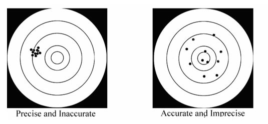
All measurements should be performed with a precision that ensures that the desired accuracy is attained.

|
|
|
True |
|
|
False |
| 5. |
Differential leveling is the process of determining __________________________________ The resulting data from leveling is a significant piece of engineering design. This data is also used for mapping and construction projects. Such elevation information is usually given in terms of feet relative to a vertical datum such as mean sea level (MSL). Mean sea level is the average height of the sea’s surface at all tidal stages over a period of 19 years.
|
|
|
The elevation of a new point from the known elevation of an existing point |
|
|
The elevation of a new point from the street level. |
| 6. |
A benchmark is an object that has a location, both vertically and horizontally, that is relatively permanent. A point on this object has a known or assumed elevation that is relative to a predetermined datum. Various organizations such as the National Geodetic Survey, the U.S. Geological Survey, and the DOT’s Survey Section have conveniently established a network of benchmarks, which are referenced to mean sea level. These benchmarks are the references normally used to establish the vertical control on highway construction projects.
|
|
|
Relatively permanent |
|
|
Flexible |
| 7. |
Which one of the followings is commonly used for the term leveling.
- Benchmark (B.M.) – Monument or point with known elevation.
- Elevation – Vertical distance above a reference or datum plane.
- Backsight (B.S.) – Rod reading taken on a point of known elevation, sometimes called a plus (+) shot.
- Foresight (F.S.) – Rod reading taken on a point to determine the elevation on that point, sometimes called a minus (-) shot.
- Turning Point (T.P.) – An intermediate reference point used when it is necessary to move the instrument ahead while running a line of levels.
- Height of Instrument (H.I.) – The elevation of the level inesight projected by the instrument, when properly set up.
|
|
|
a, and b |
|
|
a, b, and d |
|
|
All above |
| 8. |
In some cases, it is faster and more accurate to measure a distance at an angle to the horizontal and to calculate the horizontal distance than measure it with several horizontal steps. The angle up or down from the horizontal is called the slope angle, and the distance is called the slope distance.The slope distance is always _________ than the corresponding horizontal distance. |
|
|
Longer |
|
|
shorter |
| 9. |
Slope stakes are set to mark the intersection of the proposed side slope and the original ground or "catch point." Slope stakes may be placed prior to the contractor clearing and grubbing as a way to establish the clearing limits. The slope staking procedure should be discussed with the contractor and the earthwork superintendent prior to beginning earthwork operations so all personnel are aware of how the slope stakes are marked and read.
|
|
|
True |
|
|
False |
| 10. |
After the road bed is constructed, grades takes are set for final finishing.
Staking will be done for:
|
|
|
Subgrades are "Red Tops" and Base Course are "Blue Tops" |
|
|
Subgrades are "Blue Tops" and Base Course are "Red tops" |
|